Rediscovering authentic Sicily – sailing around its smaller islands
Sicily is a large, rich, and magical island. However, Sicily is more than just a single island; it also includes smaller islands and distant lands in the same sea that share the mother island’s history and ancient traditions. The islands are reclaiming their true identity now more than ever. Their names alone are irresistible to sailors and promise an unforgettable holiday. To the northeast are the Aeolian Islands, primitive but close to the mainland; to the northwest are the Egadi, a land in a beautiful natural environment of Mediterranean colours; and to the southwest are the beautiful Pelagian Islands, remote and solitary, located at Italy’s southernmost point.
They are all pieces of land, rocks, and horizons, but despite their proximity to the Sicilian coast, they are also influenced by other places, particularly Africa, which brings its smells and warm atmosphere, but also pollution. Some of these islands are steeped in mythology, while others harbour unsolved mysteries. The blue of the sea bathes Sicily’s charming coastline, secluded and almost inaccessible bays, and beaches that could be called the most beautiful in the entire Mediterranean. They offer fragments of life that flow in their own, slow rhythm and wild nature to those who visit them while sailing, as well as ancient rituals and strong flavours of gastronomy that delight gourmets from all over the world. It could be Pantelleria capers or Favignana tuna, a glass of excellent wine (Passito, Zibibbo Malvasia), fresh cannoli or coloured marzipan. Each of Sicily’s small islands is unique in its own way, and discovering them one by one while sailing enriches the soul and body.
Discover the best boat offers from Sicily
Vulcano island, the energy of fire
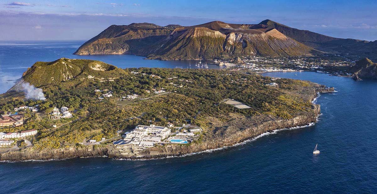
It seems as though you have arrived on a different planet when you get to Vulcano Island. It may appear surreal, like a primitive planet ruled by fire and shaped by myth. Vulcano is a geothermal energy paradise that unleashes its volcanic nature everywhere. Vulcano (Sicilian: Vurcanu) is a small volcanic island in the Tyrrhenian Sea, about 25 kilometres north of Sicily, and the southernmost of the seven Aeolian Islands. The island covers 21 km2, rises to 501 m above sea level, and is home to several volcanic calderas, including one of Italy’s four active non-submarine volcanoes. The islet of Vulcanello (123 m) is located on the north of the island and is connected to Vulcano by a land strait that can flood in bad weather. It emerged from the sea as a separate islet during an eruption in 183 BC. Between then and 1550, the three cones erupted with pyroclastic flow deposits and lavas, with the most recent eruption creating a narrow area connecting it to Vulcano.
It’s no coincidence that the ancient Greeks thought of it as the god Hephaestus’ private foundry (in Greek mythology, the god of fire and blacksmithing; son of Zeus and Hera, husband of Aphrodite). Similarly, the Romans named the island Vulcano after their god Vulcan, who they believed was the chimney of his workshop. The island grew due to his regular cleaning of slag and ash from his forge, according to Roman mythology. They also explained that the earthquakes that preceded or accompanied the ash explosions were caused by Vulcan manufacturing weapons for his god Mars’ army.
Constant eruptions have shaped an extraordinary landscape with incredibly suggestive views over the centuries; here stands out the landscape known as “la colata di ossidiana delle Pietre Cotte,” a solidified trail of lava spreading along the NW flank of the volcano near the two craters towards the town of Vulcano Porto. The sharp smell of sulphur, the blue sea that shines through the black rock, and the wellness baths in the island’s natural lakes are just a few of the island’s unique features. There are numerous physical and mental benefits, as well as a unique energy that follows you even after you leave.
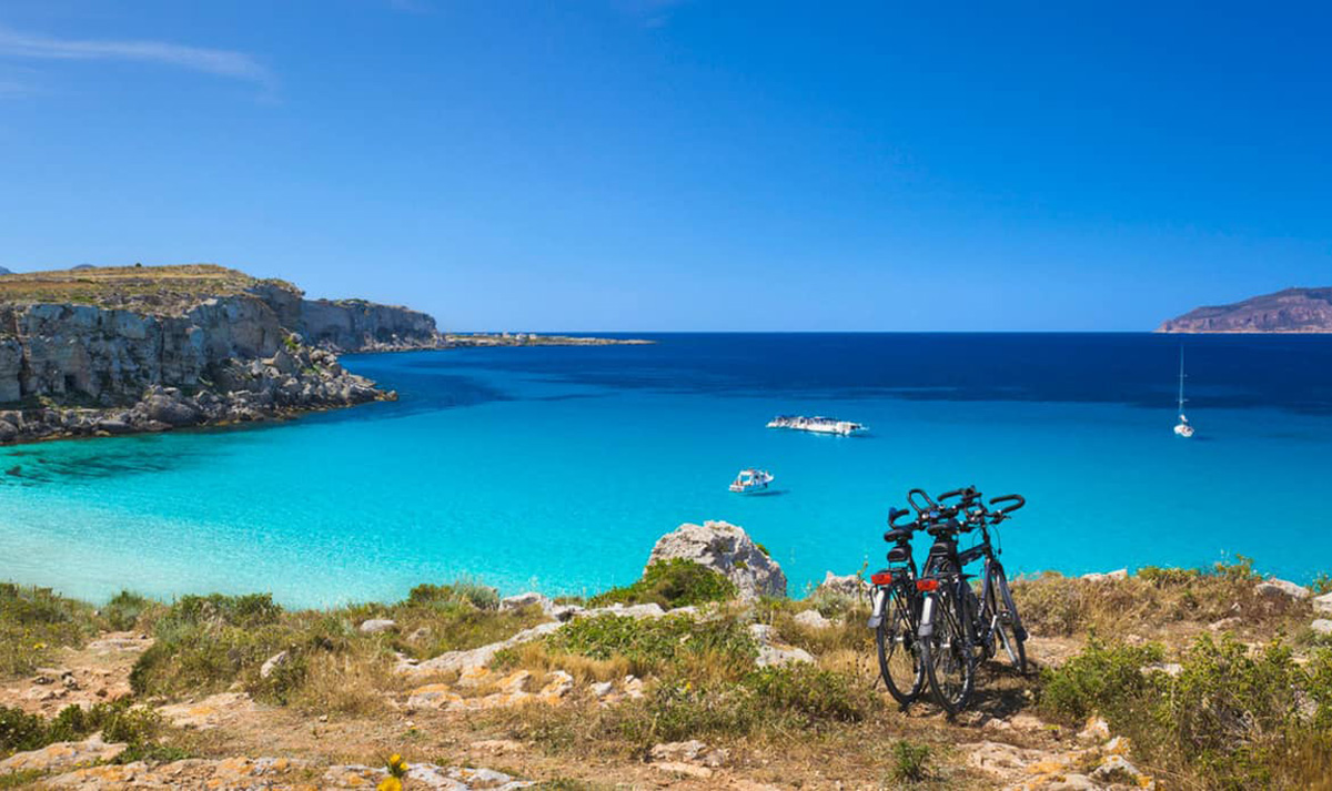
Favignana, a fantasy of nature
Although small, it is the largest island in the Egadi archipelago, located 7 kilometres from Sicily’s west coast. The island is 9 kilometres long and 4.3 kilometres wide, with a total area of 19 km2. It is a hilly island with a 302 m peak and two valleys, Piano in the east and Bosco in the west. The island, which is one administrative unit of the municipality of Favignana, serves as the administrative centre for the entire archipelago. The island was already known in antiquity when it was a powerful Carthaginian fortress. Favignana has been inhabited since the Neolithic period, as evidenced by the numerous archaeological finds discovered in the Montagne Grande caves.
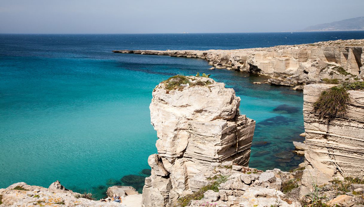
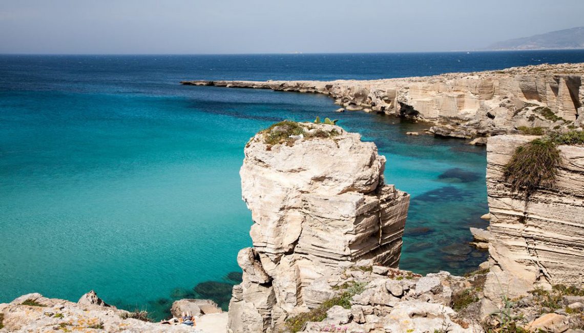
Surprising and unspoiled nature, and man’s long-term efforts to tame and live in harmony with it. These are the characteristics that surprise visitors to the island of Favignana, which is only a few miles from the cities of Trapani and Marsala but a world away in terms of time. It is a land rich in relics of the past, the first of which dates back to the Paleolithic, but above all, it has an identity that is inextricably linked to the rock. Favignana would not be the same without its calcarenite quarries, which man has shaped over the years to create unique shapes, almost “stone gardens” caressed by seawater. Then there’s the tradition of tuna fishing, which is already a true art form in this region.
The sea belongs to the Egadi Nature Reserve and is a true paradise for fishermen and scuba divers. The legendary Cala Rossa is one of the most famous beaches: the sky-blue sea surrounds magnificent white tufts of rocks, fine white sand, crystal-clear water, and small cliffs provide wonderful and unique bathing.
Discover the best boat offers from Sicily
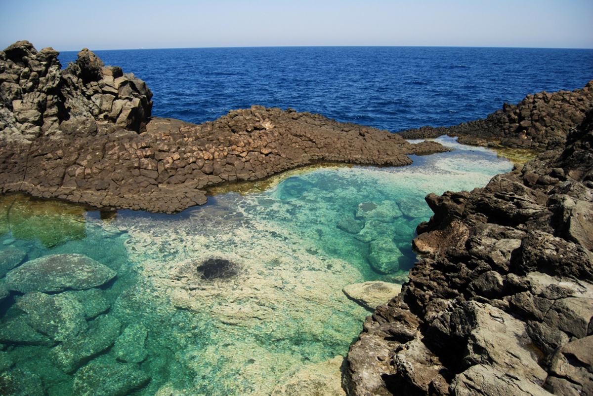
Pantelleria, the power of solitude
Today, Pantelleria, Sicilian Pantiddiria, and ancient Cossyra-this is an Italian island in the Mediterranean Sea’s Strait of Sicily, located 100 kilometres southwest of Sicily and only 60 kilometres northeast of the Tunisian coast, which can be seen with the naked eye on a clear day. Pantelleria is also the name of the town and municipality on the island, which is administratively part of the Trapani province and the Sicily region. The island’s population is 7,664(2011), concentrated primarily in the three settlements of Pantelleria, Khamma, and Scauri, as well as throughout the island in typical houses called damussi (ancient country houses built of local stone with white domes; many have been converted into lovely lodgings, such as those ideal for a Pantelleria-style overnight stay).
Pantelleria is a volcanic island that is oval in shape, elongated northwest-southeast, 13.7 km long, and 8 km wide at its widest point. The island’s total area is 83 km2, and its highest peak, Montagna Grande, is 836 metres high. The volcano’s last eruption was recorded in 1891, and volcanic activity continues on the island, resulting in the formation of geysers of 100-degree water vapour and places where sulphur vapours (fumarole) rise from the ground. There are also numerous thermal springs containing silicon and sodium carbonate. Despite this, there is a drinking water shortage on the island, and the residents rely on rainwater. The island has many depressions, which are the remains of former craters, and they are now intensively cultivated.
The island was already inhabited in the Neolithic period by people whose origins are unknown, but who were presumably of Iberian or Ibero-Ligurian origin. Many archaeological artefacts from this period, mostly ceramics, have been discovered in the village of Murcia. On the island, there are several elliptical megalithic structures known as “sesi”, the purpose of which is unknown. They were most likely tombstones or tombs (they are similar in shape to nuraghi from Sardinia, only smaller). Pantelleria has been inhabited for approximately 35,000 years, and it has always been the subject of conquests and wars due to its location and strategic importance in the strait between Tunisia and Italy. It was conquered over time by the Carthaginians, Romans, Vandals, Byzantines, Arabs, Normans, and Turks. The Arabs captured the island around the year 700 and named it Bin tal-Riyah (Daughter of the Winds), a name that has stuck to the island to this day. Benito Mussolini strengthened the island’s military fortifications during WWII due to the island’s extreme strategic importance as a protection of the waterways to Africa. Because of its strategic location, the island was critical to the Allies’ plans to land on Sicily. The Allies dropped approximately 6,200 tonnes of bombs on the island between May 18 and June 11, 1943, resulting in the surrender of the Italian units on the island.
However, for the past 10 years, the island has been a target for ships, with African migrants arriving in old, dilapidated ships.
Pantelleria is also well-known for its sweet wines, including Pantelleria Muscat and Passito de Pantelleria Muscat. Both types of wine are made from the local grape variety Zibibbo. On November 24, 2014, UNESCO added “the traditional viticultural practises of cultivating vines in the forks of Pantelleria” to its list of intangible world heritage. Winegrowers and farmers pass this down from generation to generation. Approximately 5,000 people own land where they grow low-cut vines in a unique way. There are several stages to the training technique. The terrain where the vines will grow is first levelled. In the land, hollows are dug and vines are planted. Following that, the main cane root is carefully cut into six shoots that form a radial bush. The recesses are constantly rearranged to ensure that the plant grows properly in the island’s microclimate.
The island of Pantelleria was formed as part of a submerged volcano, which explains why its intriguing landscape is carved into lava rocks. Then there’s the sea, the Pantelleria Sea, to be discovered in bays of obsidian-coloured pebbles and sand, in hidden bays that plunge into the emerald sea.
Bue Marino is the island’s most famous beach; for a different experience, anchor in Cala Gadir, a bay where you can bathe in the sea or dive into the warm water of the nearby natural pools dug directly into the rock.
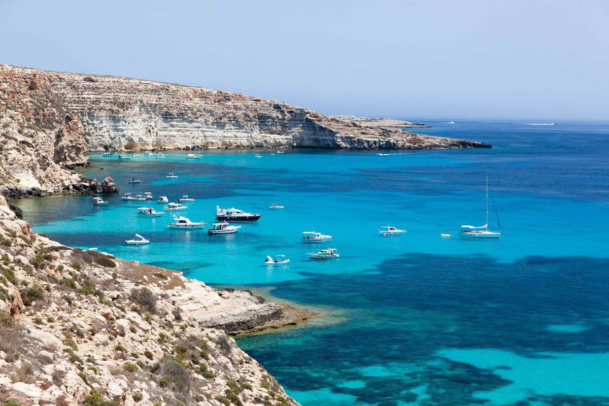
Lampedusa, the philosophy of hospitality
Lampedusa is the pearl of the Pelagian archipelago and its largest island, with an area of 20.2 km2 (it is about 9 km long and up to 3 km wide); it is also one of the southernmost Italian islands, forming a natural bridge between Europe and Africa; otherwise, it is 200 km from Sicily. This strategic location shaped its vocation to hospitality. Lampedusa is made up of the islets Linosa and Lampione. The highest point of Monte Alberto Sole is 133 metres above sea level.
Meanwhile, the islanders did the rest, earning them a gold medal for civic valour. Lampedusa is a symbol of solidarity and virtue in the eyes of the world, a country that also stands out for the protection and recovery of the large Caretta Caretta sea turtles, typical of the Mediterranean, which lay their eggs on its beaches.
The magnificent “Spiaggia dei Conigli” on the islet of the same name, a language of golden sand with an incredibly turquoise sea, is a tribute to nature, ideal for relaxing, swimming, and disconnecting from the rest of the world. Then there’s the sea at Cape Punta Parrino, a spectacle due to the vibrant seabed, a true diver’s paradise. It is an island with a barren landscape and African-inspired colours, a land that celebrates nature’s beauty and the art of encounter.
Since the beginning of the 21st century, unfortunately, Lampedusa has been known as the main refuge for African economic and political refugees on their way to the European Union, and many call it the “paradise island of despair”. Many boats carrying refugees leave Libya, and Lampedusa is part of the European Union’s mainland, which is closest to Libya’s coast.
In short, the smaller islands of Sicily are inextricably linked to the motherland’s history and geography. Archipelagos, rocks, and sea stacks are all unique, and those who sail to them will undoubtedly experience intense emotions and unforgettable scenery.
Discover the best boat offers from Sicily
You May Also Like
Magical Majorca: idyllic bays, historic villages and turquoise sea
09/03/2024
Sailing among the wonderful and ancient islands of the Dodecanese
05/12/2025