Corsica and Sardinia: Enchanting seas, history, and marine reserves
Are you thinking about a sailing cruise in Corsica and Sardinia? Given their strategic location in the heart of the western Mediterranean, it is no surprise that both islands have been invaded, conquered, and colonized multiple times throughout their long history. Yet their accessibility by sea, combined with the wild and rugged beauty of their coasts, world-famous beaches, and crystal-clear waters, makes these destinations highly sought-after by sailors.
The islands of Corsica and Sardinia stretch across the central Mediterranean and are accessible by sail from all directions. The northern coast of Corsica is relatively close to the French and Italian rivieras, while southern Sardinia is easily reached from Sicily and the African coast. Most yachts from Northern Europe reach the islands via the coasts of France or Spain and the Balearics. From Italy, the shortest route starts from Elba and Capraia in the north.
Discover the best boat rental deals in Corsica and Sardinia
Corsica: Rugged, majestic, and beautiful
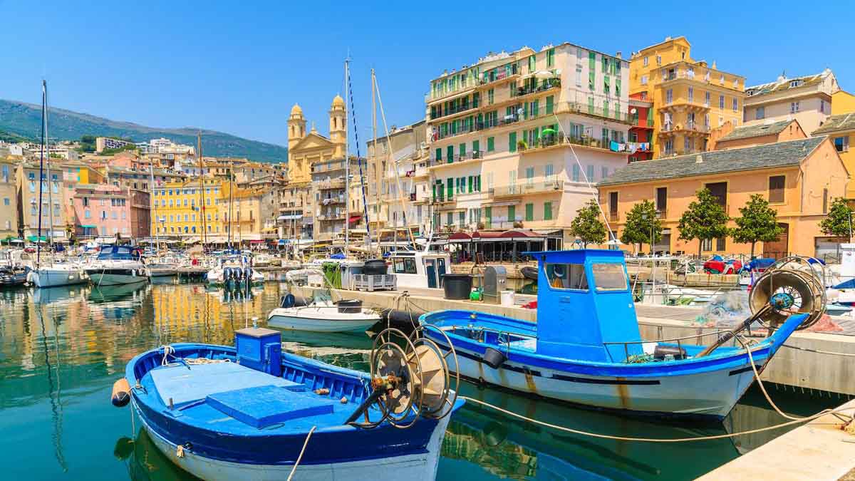
Corsica is truly a unique island. Although it is a territorial possession of France, it has its own proud identity and a strong local independence movement. Almost half of its population lives in the two largest cities, Bastia and Ajaccio, leaving the rest of the island sparsely populated.
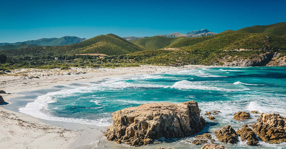
The western coast of Corsica is rugged and rocky, with magnificent headlands and charming bays lined with sandy beaches. Some parts of the coast are inaccessible by land, such as the Agriates Desert in the north, a completely uninhabited stretch of pristine coastline. Exposed anchorages in these areas make excellent daytime stops, although it is advisable to move to a more sheltered area for overnight stays.
Cliffs and stunning coves
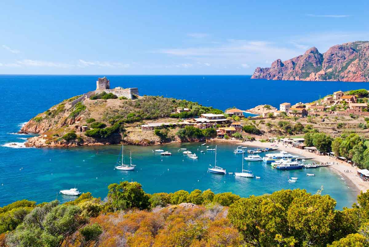
A spectacular part of the western coast to explore on a calm sea day is the Scandola Marine Reserve, part of the larger Corsican Regional Natural Park. Here the Corsican coastline is wild and desolate, becoming even more dramatic as you approach the striking Punta Palazzu promontory, where red cliffs rise from the sea like cathedrals.
During the summer months, numerous day boats from Calvi and Girolata navigate between the cliffs and promontory. One of the most beautiful coves in this reserve is Marine d’Elbo, surrounded by red rock formations, green hills, and a Genoese tower. Girolata is the only safe cove in the area and is therefore very crowded in July and August.
Further south, the coast between Propriano and Bonifacio, though extremely rocky, offers enchanting anchorages, with white sand and turquoise, crystal-clear waters amid the rocks. One of the absolute favorite spots for sailors in Corsica is Cala di Roccapina: a cove difficult to reach via a rough dirt road, making it unregulated and wild. There are no umbrellas or restaurants on the beach, no designated swimming areas, and no lifeguards. Once past the rocks in the center of the bay, it is possible to anchor close to the beach and dive into the turquoise waters.
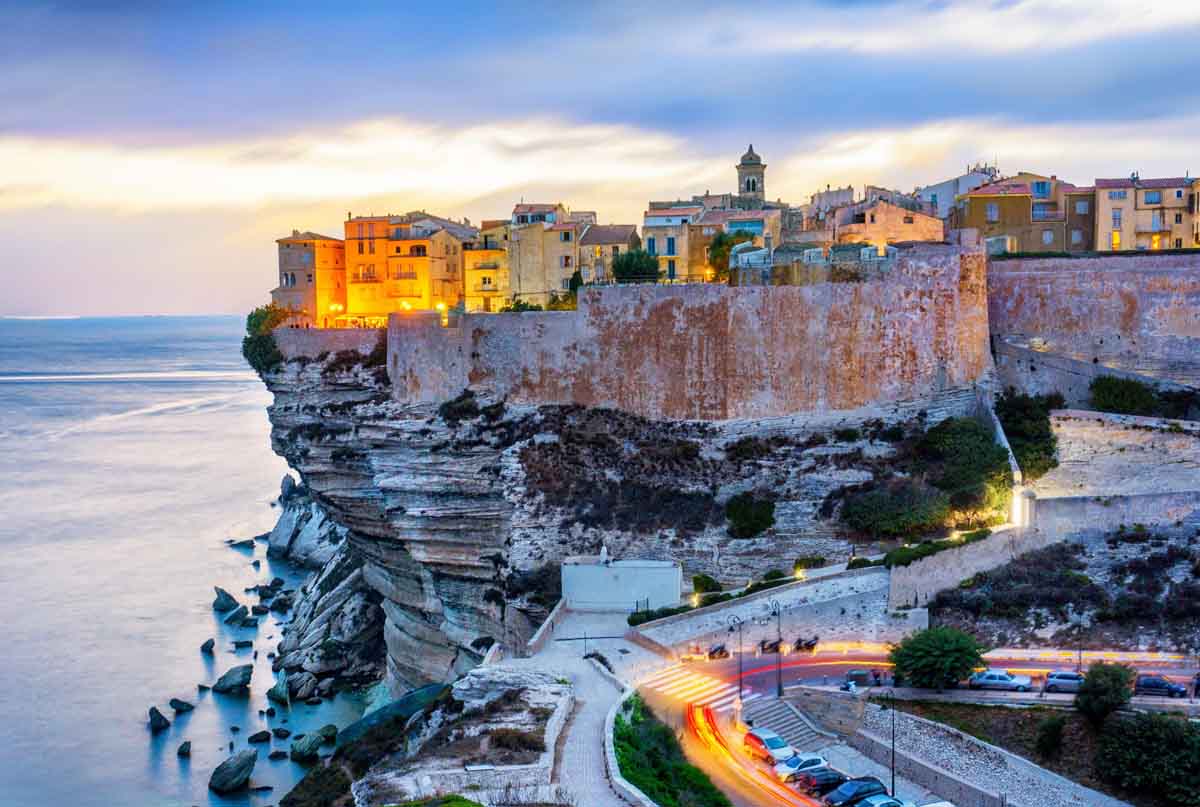
Bonifacio: An ideal sailing base
Bonifacio is one of Corsica’s most spectacular attractions. Nestled among the limestone cliffs stretching between Capo Feno and Capo Pertusato, it rises on a narrow and deep inlet flanked by almost vertical white rock slopes, crowned by a medieval walled town and citadel.
The quay is lined with charming shaded restaurants, where many evenings can be spent watching boats and superyachts maneuver in the harbor. Bonifacio is also convenient for crew changes or hosting guests, as there is a nearby airport in Figari and ferry connections.
The paradise of the Bonifacio straits
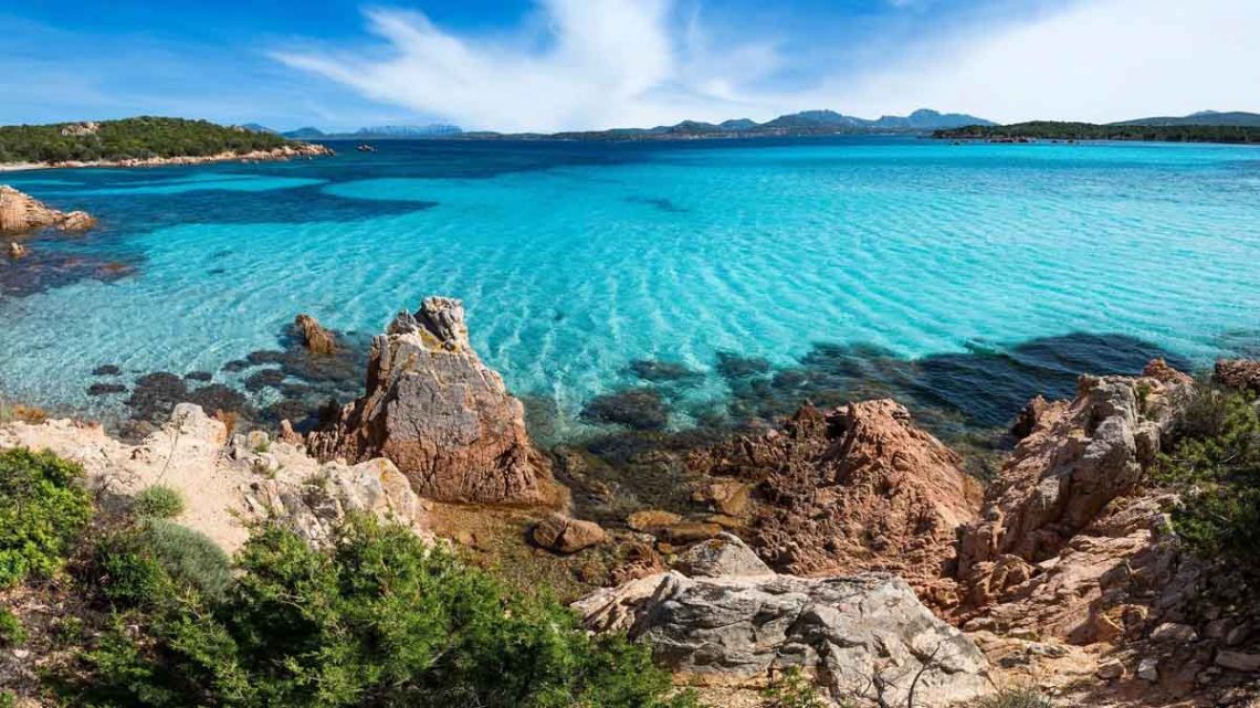
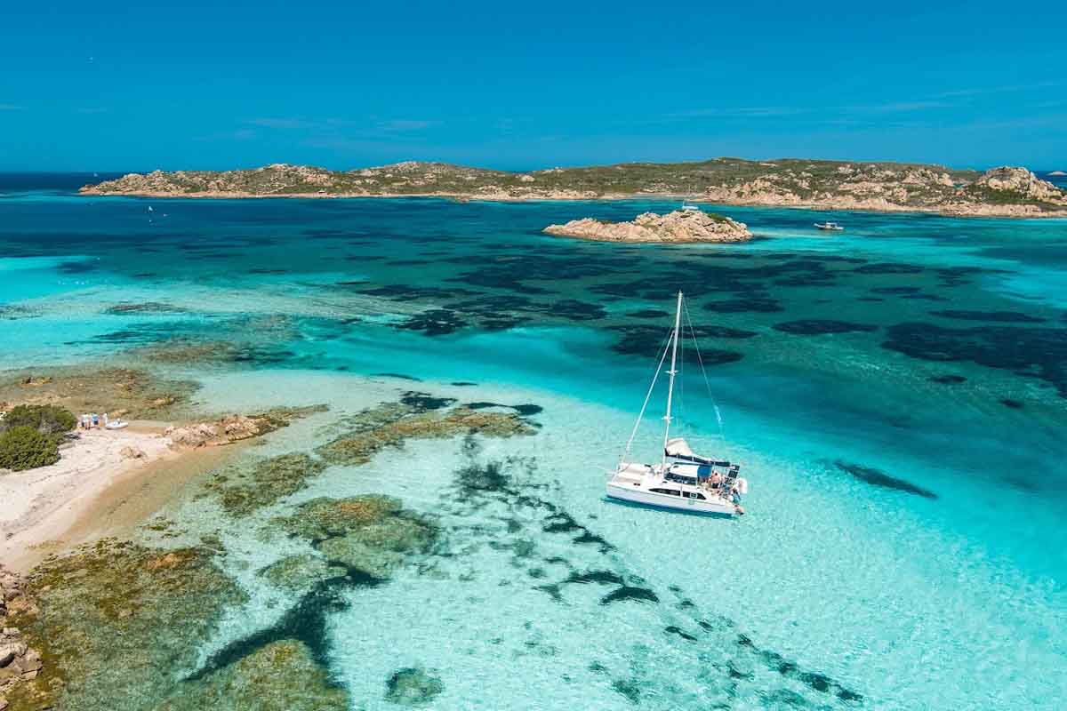
The islands of Corsica and Sardinia are separated by the Strait of Bonifacio. Within the strait, there are numerous islands and reefs, with the islands of Lavezzi and Cavallo on the Corsican side and the La Maddalena Archipelago on the Sardinian side (both Lavezzi and La Maddalena are marine reserves).
The passage between Lavezzi (Corsica) and Razzoli (Sardinia) is only 3.5 miles wide and is home to some of the sailors’ favorite spots. In the most popular bays of the Corsican and Sardinian marine reserves, buoys have been placed to prevent anchoring, and rangers are employed to collect fees.
There is a fantastic anchorage at Lavezzi (Cala Lazarina), hidden behind numerous visible rocks but open to the south. It is one of the main attractions for day-trip boats from Bonifacio and is a perfect place for swimming and snorkeling. Once ashore, pay a visit to one of the two cemeteries dedicated to the victims of the 1855 shipwreck of the Sémillante.
The bay can become uncomfortable with certain winds: the best solution is to move to another anchorage in the La Maddalena Archipelago, such as Porto della Madonna, protected from all winds except the west, or Cala Lunga, both located in the northern group of islands (Razzoli, Budelli, and Santa Maria).
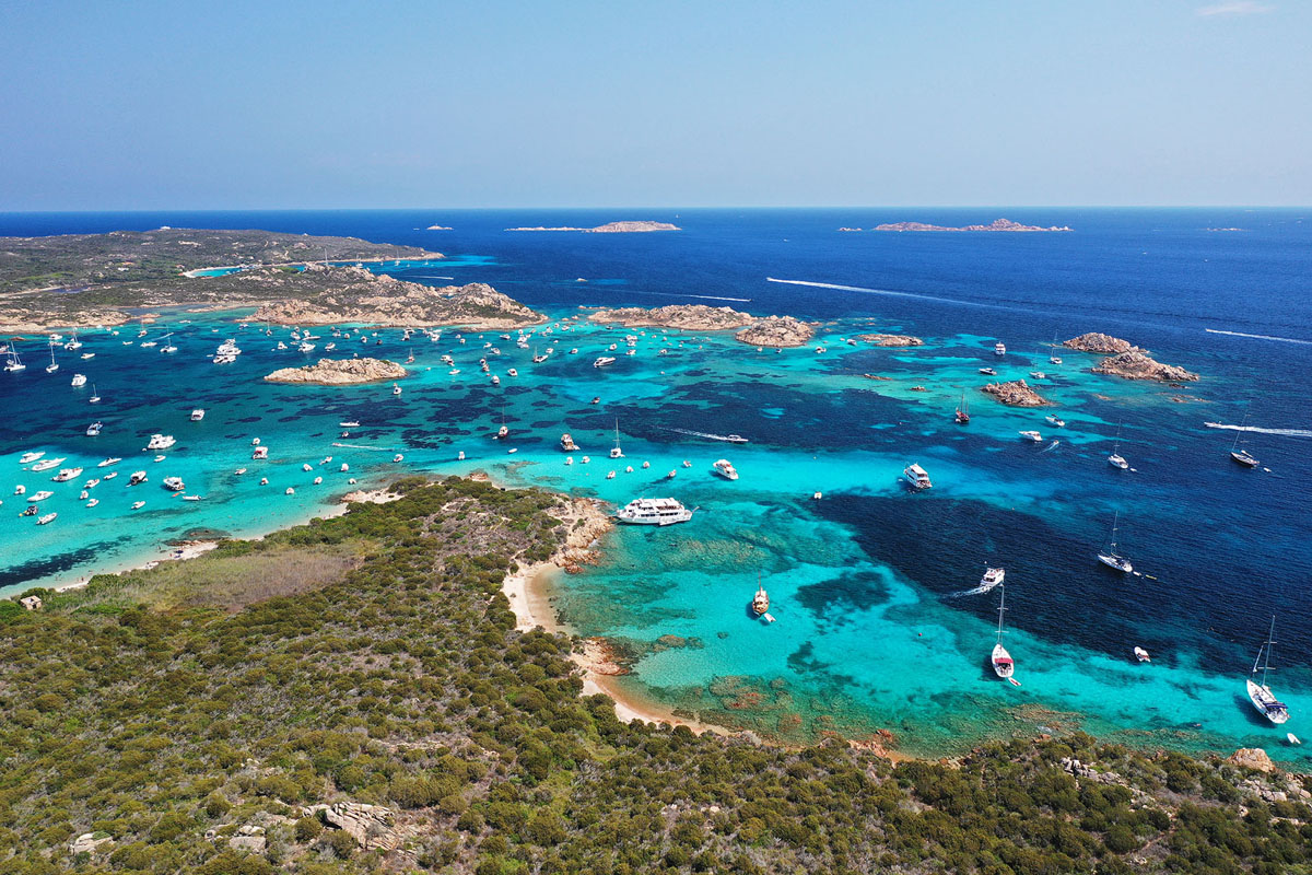
Cala Lunga has no beach but features spectacular rock formations and is much quieter during July and August. Porto della Madonna, magical in the off-season and early season (until the end of June), becomes incredibly crowded in peak season. This is due to the Passo Secca di Morto, a very shallow reef where only swimming, snorkeling, and rowing with a dinghy are allowed. The crystal-clear water is breathtakingly beautiful, but in August it turns into a crowded swimming pool.
Sardinia: The medieval city of Alghero
Sardinia’s history is as complex as its neighboring Corsica, having been a Roman province before being devastated by Vandals, Ostrogoths, Byzantines, and Saracens, then ruled by Spain before finally becoming part of Italy.
Alghero is a walled medieval town, composed of Gothic-Spanish style buildings set among olive groves and pine trees. The historic center is a charming labyrinth of narrow streets beneath turreted bastions, dominated by the Gothic cathedral and its octagonal bell tower. Sailing along Sardinia’s northwest coast from Alghero reveals stunning yet exposed and somewhat inhospitable spots, at the mercy of winds and long-traveling Mediterranean waves. Aside from a few safe harbors, there is little shelter in bad weather. In contrast, the northern coast is very rugged, with numerous bays offering excellent anchorages and beaches.
The charm of the Maddalena Archipelago
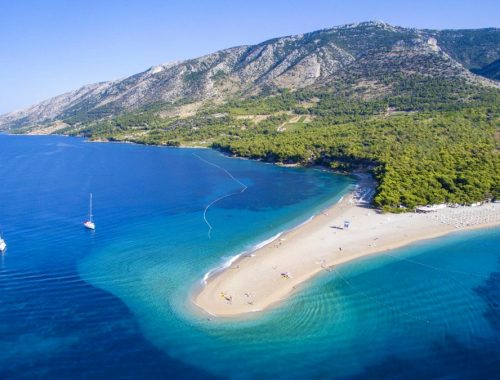
The famous Maddalena Archipelago lies to the north/northeast of Sardinia. The red granite islands are almost devoid of vegetation, except for low aromatic Mediterranean shrubs that release a distinctive scent in spring, noticeable from a distance.
The Sardinian mainland coast is so close to the Maddalena Archipelago that it provides numerous alternative anchorages if the islands themselves are too crowded. One of the most popular anchorages is Porto Liscia on Isola dei Gabbiani, a paradise for kitesurfers and windsurfers, or the more sheltered Porto Puddu.
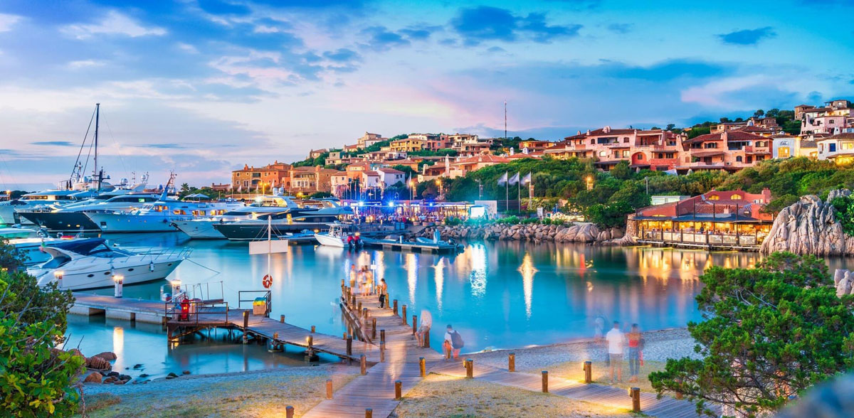
The “chic” atmosphere of the Costa Smeralda
Although Sardinia is famous for the Costa Smeralda on the northeastern coast, developed by the Aga Khan in the 1960s and home to world-renowned regattas, it is not the most attractive area we visited. The famous Porto Cervo and Porto Rotondo are quiet off-season (until the end of June), with shops and restaurants closed and limited services. The social scene becomes increasingly exclusive during July and August, and mooring fees – if you can even find a spot – are extremely high, while Porto Cervo can be dominated by superyachts refueling and stocking provisions.
Exploring remote areas
Despite thousands of visitors, Corsica and Sardinia remain wild and rugged islands. Once ashore, exploring remote and uninhabited mountainous areas by car – for example, the narrow, winding coastal road from Calvi to Cargèse – is an unforgettable and breathtaking experience. Capo Corso offers a beautiful coastal trail between Macinaggio and Centuri, called “Il Sentiero dei Doganieri,” and other stunning excursions can be found along the Desert des Agriates, where you won’t see a house, road, or car for 48 kilometers.
Weather conditions and winds
The coasts of Corsica and Sardinia have quite distinct weather patterns. The far north of Corsica, Capo Corso, is influenced by the Ligurian Sea and northern winds (Tramontana) coming from northern Italy. The western sides of the islands are dominated by prevailing westerly winds (Mistral from the northwest, Ponente from the west, and Libeccio from the southwest).
The Bonifacio Strait has a unique weather system, created by the funneling effect between the two islands, where the dominant winds are Levante (from the east) and Ponente (from the west).
Sheltered and exposed areas
The eastern coasts are influenced by the Tyrrhenian Sea and enjoy a milder climate compared to the western coasts. Corsica is partially sheltered to the east by mainland Italy and nearby islands such as Elba and Capraia. The dominant winds are Grecale (from the northeast), Levante (from the east), and Scirocco (from the south and southeast). Weather forecasts via radio usually use a quadrant system to indicate wind direction. The first quadrant (I) covers winds in the 90° sector from north to east, while quadrants II, III, and IV continue clockwise.
Thunderstorms are common in summer, usually forming near the coast or over surrounding mountains, and can be spectacular. Winds can increase from calm to force 5–6 in just a few minutes and blow in all directions, making anchoring operations in crowded areas very lively. On the positive side, these conditions are usually short-lived.
NB: Photo credits opening image: Michelangelo International Travel.


You May Also Like
What to do (and not do) when another boat calls for help
Sailing between the islands of central Croatia – a cruise of both: relaxation and adventure