The Bora: a cold and powerful wind blowing over the Adriatic
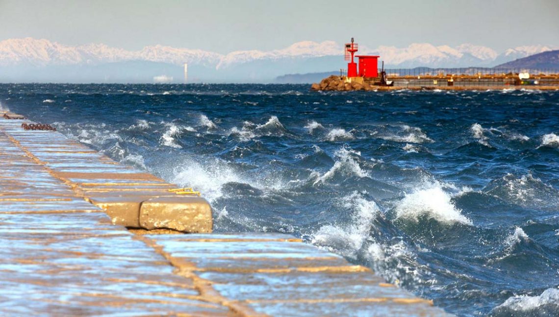
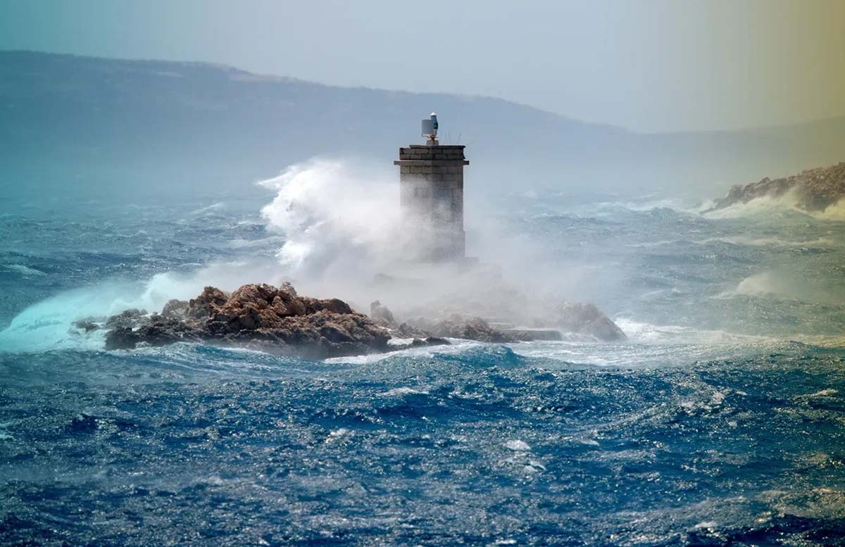
The Bora is a strong, cold wind coming from the north to northeast that regularly sweeps across the Adriatic, especially along the Croatian coast. It has long inspired both respect and fear—even among the most experienced sailors. When it blows with full force, it can whip up the sea and cause serious damage, even in well-sheltered marinas. But how does it form, and when is it at its strongest?
The Bora is a katabatic wind—a type of downslope wind. These winds develop in mountainous areas when large masses of cold air accumulate at high elevations. Driven by gravity, the dense air rushes down the slopes toward lower altitudes—in this case, toward the sea. By the time it reaches the coast, it has gained remarkable speed. Here, the cold air sinks beneath the warmer, lighter air above, lifting sea spray that the gusts carry across the water, the mainland, and the islands. The Bora tends to blow with roughly the same intensity during day and night, though it may weaken slightly between noon and mid-afternoon. For sailors, the danger lies in the Bora’s unpredictability: it can appear suddenly and strike with storm-like force, leaving no time to prepare. It is also characterized by violent gusts that can make navigation extremely challenging.
Discover the best boat rental deals
When does the Bora blow?
The Bora must always be taken into account when planning a sailing trip—particularly in autumn and winter, though it can also occur in spring. A strong winter Bora can last up to a week and reach speeds of around 300 km/h. In the past, July and August were considered relatively safe months, but due to climate change, that’s no longer guaranteed. In recent years, sailors have occasionally encountered fierce summer Bora winds, though these usually subside within three days and are less intense.
How pressure systems influence the Bora
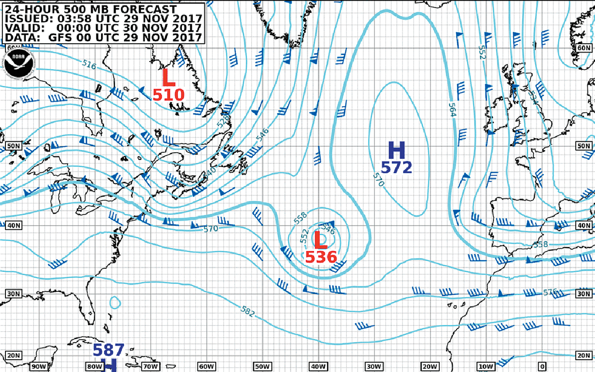
Atmospheric pressure plays a major role in the formation of the Bora. The cold air mass can be reinforced by a jet stream created at the meeting point of high and low pressure zones. This happens mainly in two scenarios: when a high-pressure system settles over the snow-covered Dinaric Alps and a low-pressure system forms over the warmer Adriatic; or when a low-pressure area from the Black Sea region meets a high-pressure area around the Balearic Islands. At their intersection, a powerful current develops, blowing southward from the mainland and carrying with it the cold air from the Dinaric Mountains.
Why Croatia is the homeland of the Bora
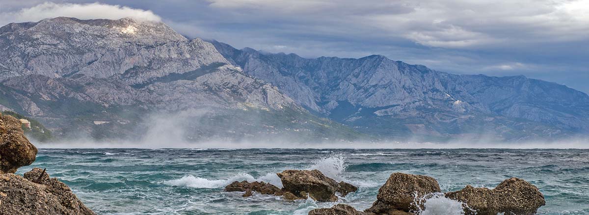
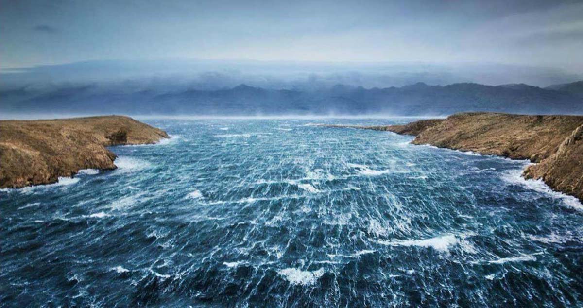
The Dinaric Alps are a mountain range stretching 700 km from Slovenia to Albania, running along much of the Croatian coastline. These mountains create the perfect conditions for powerful Bora winds. The main contributors are three ranges: Velika Kapela, Velebit, and Biokovo.
The Velika Kapela Bora can be encountered when sailing from Pula or Rijeka among the islands of the Kvarner Gulf—Krk, Cres, Rab, Prvić, and Goli Otok. The strong, consistent winds here have shaped the northeastern and eastern parts of these islands and also impact coastal towns such as Crikvenica and Senj. Sailors should pay particular attention in the Vinodol Channel, between the mainland and Krk Island, where the terrain intensifies the Bora.
The treacherous Velebit Channel
The Velebit Channel is one of the areas most prone to fierce winds. Here, the Bora devastates the mainland, the coast, and the nearby island of Pag—which is nearly barren because of it—as well as the Novigrad Sea, which connects to the Velebit Channel via the Novska Strait. This narrow passage acts as a funnel, accelerating the Bora and making the wind even stronger.
The famous Makarska Riviera is similarly affected by Bora gusts from the Biokovo mountains, along with surrounding winds funneled through river valleys and mountain passes. These gusts also impact Šibenik at the mouth of the Krka River, Split, and Omiš. Further south, the Bora comes from the mouth of the Neretva River, reaching the Mljet Channel and the Pelješac Peninsula. Even Dubrovnik experiences Bora winds, although they weaken as they move further south.
Tips for sailing with the Bora
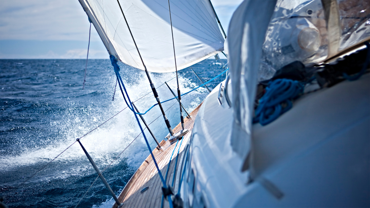
The Bora weakens as you move further from the coast. For this reason, it can sometimes be safer to sail offshore rather than trying to anchor in a poorly protected harbor. However, this strategy is not without risks and should be considered a last resort. The Bora does not create very deep waves, but the waves are short and choppy, making maneuvers difficult. Strong winds tend to push vessels away from the mainland, which in Croatia usually means toward an island. Make sure not to sail on the windward side of the Bora, or the wind could drive you onto shoals or rocks. One might assume that a jagged coastline provides shelter, allowing you to hide in more protected bays. In reality, the opposite is true: not only does the coastline fail to provide protection, but you may also encounter unexpected gusts funneled through narrow passages—a kind of natural wind tunnel. In addition, the Bora stirs up spray, reducing visibility and making navigation more challenging.
Experienced crews can sail in milder Bora conditions if confident, enjoying fast and somewhat exhilarating sailing. However, the Bora is unpredictable, and sudden gusts are the greatest risk, as they can tear sails or cause unintended maneuvers.
Mooring while the Bora is blowing
The Bora makes mooring nearly impossible in the northern and northeastern parts of most Croatian islands. Some ports do not even operate during strong Bora winds because they are unsafe. Conditions are better in the southern and western parts of the islands, but caution is always necessary. The Bora can rise tens of meters above ground when at full strength, crossing hills and islands without losing power. Strong gusts can occur anywhere, from Cres to Mljet and along the sides facing the open sea.
A practical concern is that in peak season, the safest and most sheltered ports fill quickly. When planning your itinerary, it’s wise to have one or two alternative anchorages in reserve. Increasingly, marinas allow you to book your berth online in advance.
Finding shelter from the Bora
Western Istria is well protected from the Bora, so crossings from Croatia to Italy are usually trouble-free. Despite winds from the Biokovo mountains, the waters south of Hvar, Brač, Vis, and Šolta are calmer because they are farther from the mainland and less affected by the Bora than the Velebit Channel.
Near Zadar, the best shelter is provided by the well-protected bays of Ugljan and Pašman. Dugi Otok also benefits from its more sheltered location. The southern sides of Lastovo and Mljet islands are relatively safe as well, partly protected by the Pelješac Peninsula, thanks to the weaker Bora winds coming from the Neretva estuary.
Can the Bora be predicted?
The Bora often appears suddenly on sunny days, unlike the Sirocco, and most frequently during high-pressure conditions when the sky is clear and no weather changes are expected. Large white clouds on mountaintops can indicate its approach. Isobar maps can also provide clues: the Bora begins when high and low-pressure systems meet.
The most reliable method is to monitor forecasts and listen to local radio and television broadcasts. Narrow channels may also experience localized winds caused by differences in temperature between the sea and the land, not just pressure. Unfortunately, there is sometimes no warning at all.
We don’t want to unnecessarily scare anyone. In summer, it’s rare to encounter a Bora that cannot be managed. Simply paying attention to the forecasts is enough. After all, that’s good advice whenever you go sailing.
Discover the best boat rental deals


You May Also Like
Capri, the most romantic and glamorous island in the Mediterranean
Sailing along the coasts of Brittany, a land of sailors surrounded by the ocean