
Discover the magical Lefkada, the wonder of the Ionian Sea
7-day sailing tour of the beautiful island of Lefkada, a place with an authentic and relaxed atmosphere away from the crowds of tourists, where we find rare beautiful shores overlooking the bright blue sea.
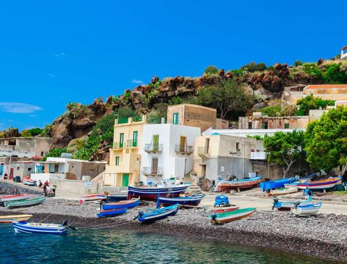
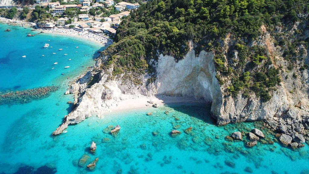
Lefkada, also known as Lefkas, is one of the best places to start exploring the Ionian Islands by sailboat, with an easily accessible airport in nearby Preveza (approx. 1 hour from the city of Lefkada). World-famous islands like Kefalonia, Ithaca, and Kalamos are all just a few nautical miles away from Lefkada. The island of Lefkada has a total area of 336 km2, with the highest peak being Stavrota (1158 m), and is separated from the mainland by a 2 km wide isthmus (today the isthmus is bridged by a bridge). Lefkada is mostly rocky and hilly, with a few small fertile valleys. These valleys produce olives, vines, citrus fruits, fruits, and vegetables.
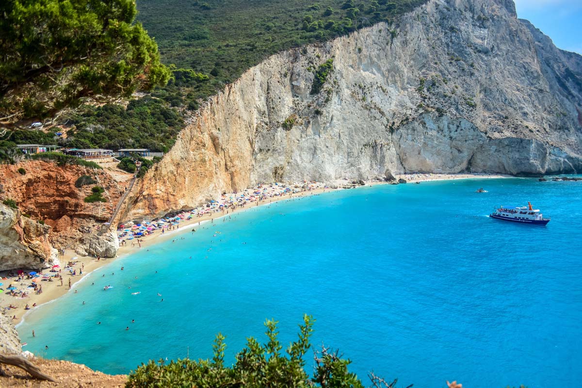
Lefkada was not always an island, but it was joined to the Greek mainland by its northern tip. However, the island was separated from the mainland as early as the 7th century BC. The Corinthians established the first settlements around 640 BC in order to sail along the mainland under the protection of the island. The waterway is only 5 metres deep today. Smaller settlements, such as Ligia, Nikiana, and Perigiali, can be found on the island’s east coast. All settlements are north of Nidra’s largest settlement and resort on the east coast. From here, you can see Skorpios Island, which was once owned by Aristotle Onassis but is now owned by the Russian Rybolovlev family. From this side, you can also see the island of Meganisi and other smaller islands, as well as the coast of mainland Greece, and ferries can be taken to the islands of Kefalonia, Ithaca, and Meganisi. Vasiliki, the island’s central surfing hub, is located in the south of the island. Ferries connect Vasiliki to Kefalonia and Ithaca. Vasiliki is connected by the central coastal road to Nidri (20 km) and Lefkada’s capital. It leads through the villages, and the ring road connecting the settlements on the island’s west coast has also been completed. The Greek poetess Sappho jumped to her death from a 30 m high cliff at Cape Lefkada in the island’s south.
If you want to go a little further south, the popular island of Zakynthos with its famous beach awaits you. The equally beautiful islands of Paxos and Antipaxos, as well as the mainland areas of Parga and Sivota, await you in the north, while the world-famous island of Corfu has enough to keep you busy for several days.
Because of the close proximity of the islands, the entire eastern part of the Ionian Sea is weather-protected and sunny most of the year, but also windy enough to enjoy sailing.
Day 1, Lefkas – Meganisi, 11 miles
This itinerary begins in Lefkas’ national port, from which we sail for a few hours to Meganisi, which is located between the island of Lefkada and the Greek mainland, right next to the island of Skorpios.
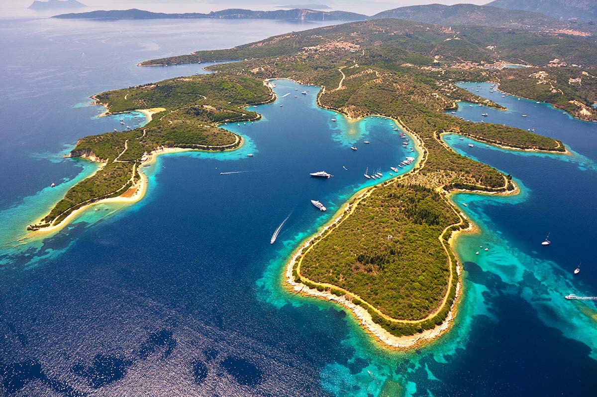
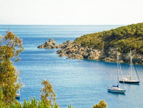
Meganisi is a beautiful island with many swimming spots. The island has a total area of about 22 km and is separated from the mainland by a couple of kilometres wide sea channel. Its coast is adorned with fjord-like small beaches and pristine and secluded bays. Moor in the natural harbour of Spilia in Spartochori or the marina in the village of Vathy for a stopover.
Katomeri (453 inhabitants) and the ports of Vathy (145 inhabitants) and Spartochori are the only villages on the island (Greek Spartochori, 492 inhabitants). Athena Bay also has a harbour, which is mostly used by fishing boats. Ferries from Vathy and Spartochori connect Meganisi to Lefkada. Meganisi has a primary school, an ATM, and several churches. On the island, there is a hotel and a few other smaller accommodation facilities for tourists. Because the island lacks a secondary school, students attend nearby schools in Nidri or Lefkada.
Some researchers, including Wilhelm Dorpfeld, estimate that Meganisi is the Homeric island of Krocylea, which was part of Odysseus’ “kingdom”.
There are several natural bays on the northern side of Meganisi, surrounded by the lush Ionian landscape. On the southeast side, there are several caves, the most notable of which is the Papanikolis cave. It was named after the Papanikolis submarine, which was used during WWII and took refuge here (today this submarine can be seen in the Maritime Museum in Athens). Bathing in the cave is a once-in-a-lifetime experience because the crystal water allows you to see all the way to the bottom. You can even see the stalactites hanging from the roof if you look up. Swim inside the cave to a small sandy beach and take in the breathtaking scenery. However, due to the deep water and rocky bottom, you will be unable to drop anchor.
Also worth a visit are the islands of Thilia, which are protected from the north-west winds, Atherinos Bay, which is a popular destination for locals, and Abelakia, which has some traditional Greek tavernas for lunch after swimming. For those seeking privacy, the islet of Kithros is located off the southern coast of Meganisi and can accommodate up to two boats at a depth of eight metres.
Day 2, Meganisi – Kalamos, 15,5 miles
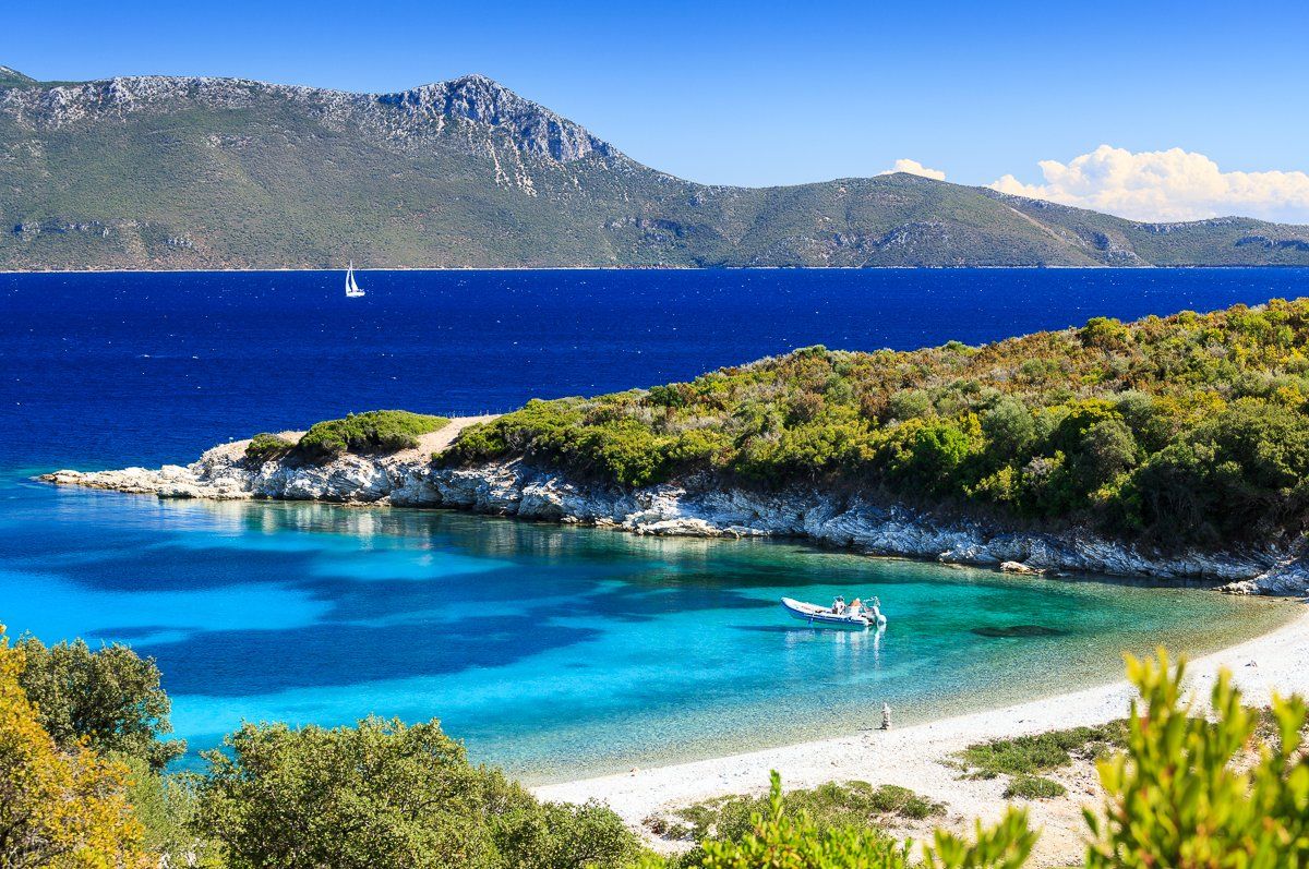
When we leave Meganisi, our next destination is only a 2-hour boat ride away, and we can see Kalamos with its mountainous appearance from afar. The island is situated in the protected marine area of the inner Ionian Sea. So the island, with its bushes and shining pines, welcomes us with open arms, overlooking small deserted beaches with sand and pebbles, bathed in turquoise and crystal water. Mooring in Kalamos, once a fishing haven, immediately allows us to fall in love with its picturesque and relaxed atmosphere, with a few tavernas to enjoy local food and drink. The Coast Guard headquarters is also located at the port for any nautical information.
Agios Donatos, named after the ancient Christian chapel that was built there, is another stop for exploring the island and especially for swimming. We can anchor here on the 5-meter sandy bottom and remain protected from the north-westerly winds. Asprogiali entices us as well, with its two small beaches, dense pine forest, and emerald water.
The name Kalamos means “reed” in Greek, and the presence of this plant along the island’s coast may have given the island its name in the past. Another explanation is that the island had several sandy beaches (Kali Ammos in Greek), hence the name. The island has a population of 496 people, a land area of 24.964 km2 (9.639 sq. mi), and its highest point is 754 m above sea level, according to the 2011 census. The main settlements on the island are the port town of Kalamos (454 inhabitants) on the island’s east coast and the northern town of Episkopi (42 inhabitants), the island’s only inhabited village. The village of Kefali, also known as Porto Leone in Venetian, was abandoned following the 1953 Ionian earthquake. The main church is still in use and houses the holy image of the Virgin Mary, which is also thought to work miracles. The church and the holy image commemorate twice a year, on June 30 and August 15. Traditional celebrations with folk music precede the religious celebration on this day. People arrive from all over the island.
Finally, there’s Formikoula, a one-of-a-kind island accessible only by sea and remote enough to be home to a Mediterranean seal.
Discover the best boat offers from Lefkas
Day 3, Kalamos – Kastos, 6,1 miles
We arrive on the island of Kastos after a one-hour sail, another small virgin island with lots of greenery and smiling people, but only a few tavernas and a supermarket. It is the ideal refuge for a sailing crew due to its strategic location and magical atmosphere, where only peace and harmony can be found. Despite the fact that Kastos is only a kilometre wide and 8 kilometres long, it manages to combine a variety of landscapes: rocky in the west is replaced by sandy and pebble beaches with electric blue water in the east, where there are bays with numerous safe mooring points.
The entire island is home to less than 100 people, mostly elderly people who welcome tourists and relatives returning home for vacation during the summer. Because there are very few cars on the island and access for other cars is restricted, anyone wishing to travel along the entire coast of the island can request a ride from one of the village elders, who can also serve as a personal local guide during their stay. Tip: Before leaving Kastos, make a quick stop at Wasp Bay to enjoy the island’s turquoise waters (although there are no wasps to be found).
Otherwise, the island is truly miniature, but it does have its own small and friendly museum in the town of Kastos. The skeleton of a young whale that washed ashore on the island in the 1970s is the main attraction here. Locals are very knowledgeable about the items on display and will be able to provide you with interesting details about everything. This is quite interesting for a few euros.
Tip: Visit the Windmill restaurant and bar, which is right on the beach and has an incredible view.
Day 4, Kastos – Itaca (Vathi), 17 miles
Every sailor must visit Ithaca, Odysseus’ mythological island, at least once in his life. We only need 3 hours of sailing from Kastos to reach this legendary island, which stretches north-south and is 23 kilometres long, with a total area of 96 km2. A channel 8.5 km long and 2 to 4.8 km wide separates the island from Kefalonia to the west. The coast is approximately 72 km long. Ithaca is mostly rugged and hilly, with olives, vines, vegetables, and fruits grown in a number of small valleys. In the north, the three largest mountains are Pataleiko, Homer’s Mount Neritos, and Exogi.
The island owes its fame to Greek myths. It is best known as the birthplace of the Greek hero Odysseus in Homer’s epics Iliad and Odyssey. Many poems and works of literature use the name Ithaca to represent a destination, longing for home, nostalgia, and return. The name of Ithaca has remained unchanged since ancient times. There are various explanations for the origin of the name Ithaca; some believe it comes from the mythological hero Ithaca, while others believe it comes from the Greek word “ithy,” which means happy, and still others believe it comes from the Phoenician word “utica,” which means colony.
The island was most likely inhabited between 3000-2000 years before our time. It was the seat of the Kefalonia region during the Mycenaean period. The island was conquered by the Romans in the second century BC, and it later became part of the Byzantine Empire. Ithaca was ruled by the Normans in the 12th and 13th centuries, and then by the Turks for a short time before falling into the hands of Venice. It was then occupied by the French at the end of the nineteenth century before being conquered by the British in 1809. It was liberated and annexed by Greece in 1864. The majority of the island’s architecture was destroyed in an earthquake in 1953, and the population of the island also decreased significantly at the time, as most people moved to larger Greek cities (today, approximately 2,500 inhabitants still live on the island).
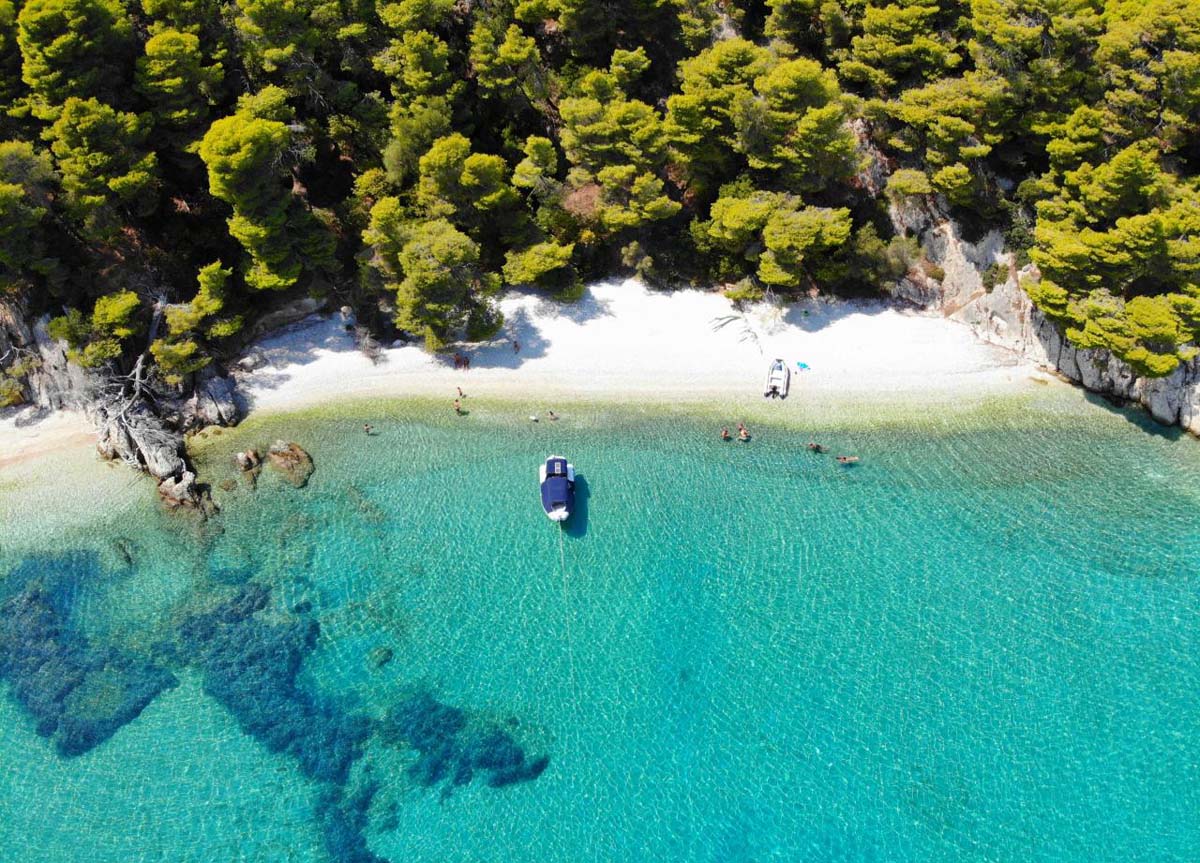
Its incredible white-rock coastline is dotted with many traditional villages and beautiful bays, and its emerald green waters are ideal for water sports such as diving and kayaking. Vathi, Ithaca’s main port, is also the largest natural harbour in Europe, offering a variety of services while also being lively, with characteristic two-story traditional houses lining the docks. The western side of the harbour is recommended for mooring. The small archaeological museum and the Museum of Folklore and Culture make the town itself worthwhile to visit. Not far from the city are the legendary nymph cave (Marmarospilia), Arethusa’s spring, and the ruins of the ancient city of Alalcomenae. There is also an archaeological museum in Stavros (the island’s second-largest town) that houses ancient relics discovered in the Loizou cave and excavations on a hill near Pelikata. The ruins of the ancient palace, which many historians describe as the property of the legendary Odysseus, are, of course, the main attraction.
Kioni, a village built in the shape of an amphitheatre, is one of the most interesting destinations on the island, with small houses interspersed with olive and pine trees that permeate its cobbled streets. So is Frikes, a fishing village at the end of a long, narrow bay dominated by two windmills. Definitely worth a visit are Afales, with its white sand in contrast to the turquoise water; the Polis Bay, located north of Vathi; and Ormos Schinos, one of Ithaca’s largest bays, from which we can reach the beautiful Gidaki beach via secret paths. Filiatro, Sarakiniko, and Agios Andreas are also recommended beaches.
Day 5, Itaca (Vathi) – Cefalonia (Fiskardo), 15,5 miles
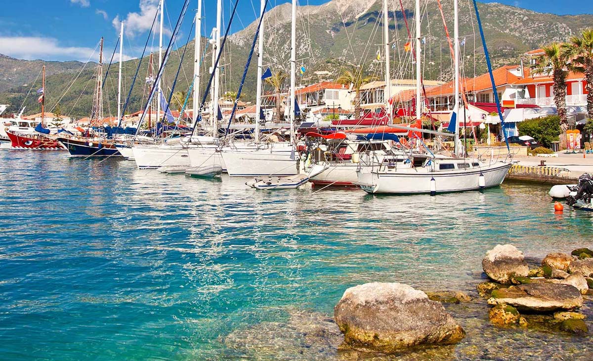
It’s time to leave this mythologically rich island and sail to a new destination: Fiskardo in Kefalonia, where we’ll arrive in about 2.5 hours. Despite its worldwide fame, the island of Kefalonia has managed to avoid mass tourism and retain its authentic identity and crystal-clear water. The island has many picturesque bays ideal for mooring and only accessible by sea. Fiskardo is located in the northern part of the island and is an ideal place to moor and enjoy the peace and quiet of the ancient port or sample the delicacies at the local taverns. Due to the wind, it is sometimes difficult to enter the bay from the east side, so it is recommended to enter from the west and shorten the path along the port itself.
The island is thought to have gotten its name from the mythological figure Kephalus (Cifalis). There is a popular belief that the name comes from the shape of the island, which is why it is also known as “head island” (Greek: ke^oAi – head). Kefalonia is the largest island in the Ionian Islands group (it measures 773 km2), with a population of around 45,000 people. It is one of Greece’s fastest-growing regions in terms of population, with a growth rate of 35% to 40% in the 1990s. Argostoli is home to one-third of the island’s population. Liksuri is the island’s second-largest settlement. These two cities are home to nearly two-thirds of the island’s population.
As an alternative to the mooring, you can go to Agia Effimia, which offers a beautiful view of the green mountain that surrounds this central village of Kefalonia, or the quiet port of Sami, which is protected from the northeast winds and where you can visit the Melissani cave. Other destinations worth seeing include the Poros Gorge, which legend attributes to Hercules or the Cyclops, the village of Assos, built amphitheatrically around the peninsula, with traditionally coloured houses of Ionian architecture, and the bays of Antisamos and Fokas, where you might be able to swim with seals. On the east side of the island, Agia Sofia is a quiet beach and a good place to stay due to its easy mooring; in the summer, the Drogorati cave is also very popular among tourists, with a constant temperature of 18 C.
Perhaps the most famous appearance of Kefalonia in popular culture is in the novel Captain Corelli’s Mandolin by the English author Louis de Bernieres. The village of Farsa, just outside Argostoli, is said to have inspired the book. The book’s central love story takes place before and after the Acqui Division massacre during World War II. The film adaptation was released in 2001. During filming, the production team, local authorities, and citizen groups had a lively discussion about the complex historical details of the island’s anti-fascist resistance. As a result, political references were omitted from the film, but the book’s romantic core was preserved without delving into complex debates about the island’s history. Riccardo Milani’s TV film Cefalonia, also about the massacre, was released in 2005, with music by Ennio Morricone.
Day 6, Cefalonia (Fiskardo) – Lefkas (Sivota), 12 miles
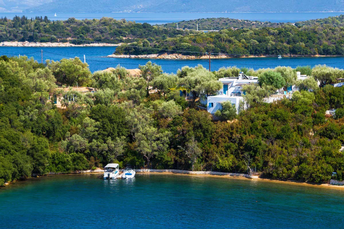
We travel from Fiskardo to the picturesque village of Sivota on Lefkada, passing the island of Arkoudi with its small bays and steep rocks. The beautiful bay of Sivota is located in the southern part of Lefkada and is made up of two long strips of land that hug the sea. The horizon line of the open sea is almost completely hidden in this manner, giving the impression that you are on the shore of a small lake. Sivota was originally intended to be a small fishing village, as fishermen are still the primary source of income in this part of the island, which has only recently developed as a tourist destination. The many restaurants where you can taste the best fish on the entire island of Lefkada at very reasonable prices show how important fishing is to Sivota.
Sivota is a very small village because, in addition to some villas, it has a series of inns and traditional shops that line the entire length of the pier, where many boats are moored. A small stone beach in front of the pier is lapped by a clean and rather cold sea, ideal for cooling off from the scorching Greek sun. When the sun goes down, Sivota’s unique beauty shines through. In fact, all of the lights from the restaurants and moored boats are reflected on the calm waters of the Greek sea in the evening, creating a rather suggestive atmosphere, especially if viewed from the panoramic terrace of one of the pier restaurants.
Day 7, Sivota – the city of Lefkas, 17 miles
Our time on the island of Lefkada is coming to an end. However, before returning to our nautical base in Lefkada, we can start the last day early and, after a short navigation, stop for a swim at the famous Onassis Island (Scorpios); or in any of the islets and bays we will find on the way back. Just enough time to rediscover the tranquillity of life on a boat in one of Greece’s most charming corners of the Mediterranean.


You May Also Like
How wonderful it is to sail between these 3 stunning islands – Elba, Capraia and Corsica
Sail and explore the Exuma Islands in the Bahamas for tropical delights