Sailing among the beauties of the Tuscan Archipelago
The Tuscan Archipelago with its 7 main islands and as many uninhabited islets is the best you can ask for for a sailing holiday: unspoiled nature, crystal clear waters, fragments of history and a relaxed atmosphere. Four of these islands, from North to South, named Capraia, Elba, Giglio and Giannutri, are freely accessible to all sailsmen. The other three: Gorgona, Pianosa, Montecristo, are forbidden to navigation for various reasons, even if they can be easily visited, with prior authorization. All of them are part of the natural reserve of the Tuscan Archipelago which protects their habitat and traditions and effectively prevents mass tourism. The distances between them do not exceed 25 miles and also allow planning the navigation on spot.
Day 1, Scarlino marina, boarding
Our itinerary starts from the base of Marina di Scarlino, in Tuscany, which is a few miles from the islands and is located in a central of the Archipelago, thus representing an excellent embarkation and disembarkation point for a loop tour. Usually we board at 5 pm, and then spend the first night in port to relax and enjoy an excellent dinner.
Day 2, Scarlino marina-Giglio, 35 miles
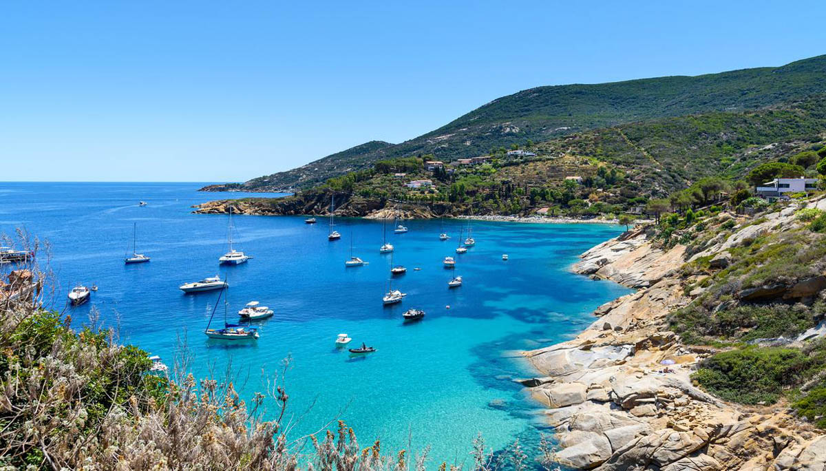
In the morning we leave for the splendid island of Giglio, much loved by boaters, including foreigners, thanks to its magical beaches and the interesting mix of historical and artistic remains that it offers. It is called this way because in spring it transforms into a green oasis covered with white lily flowers (which are called “giglio” in italian), even if in reality it is a mountainous and granite land, famous for the small terraces with dry stone walls called “greppe”, whose maximum height is 498 meters – the Poggio della Pagana. The island has three villages on its territory. The first is Giglio Porto and hosts the only marina that we will use for the mooring. With its colorful appearance and always full of traffic, it is located on the North East coast of the island and is protected by two piers. Here you can explore Torre del Saraceno. Along the east and west docks there are about 60 berths on a seabed with a depth of 1-2.5 meters. Among the services there is water and fuel in the dock, while on land you can choose between many of the markets, shops, bars and restaurants in the village.
The other village on the island is Giglio Castello, also of medieval origin, while Giglio Campese, once only a village of fishermen’s huts, has recently been transformed into a tourist center, thanks to the presence of a beautiful beach right on the edge of the village. Among the other bays to see there are certainly Cala Cannelle located south of Giglio Porto which has a beautiful sandy beach with a rocky shore, but also Cala delle Caldane on the east coast. Doppiata Punta di Capo Marino is a small and wild bay with a small beach, in front of which we can give anchor 100 meters from the shore, in 5-10 meters of water on a sandy bottom. Cala dell’Allume, recognizable by the rock Cappa which is located 400 meters south from its entrance, and Baia di Campese, an excellent anchorage and sheltered from all winds except those from the North West, are also good places to visit.
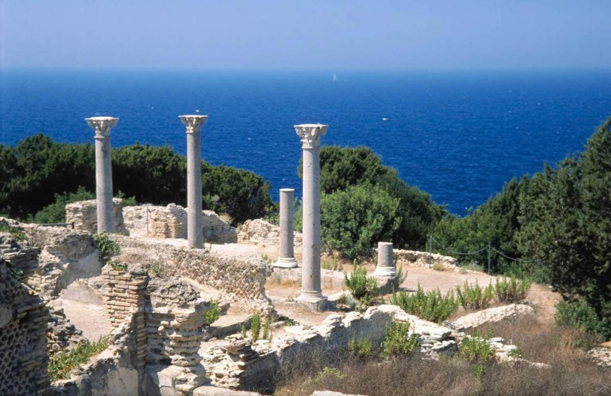
Day 3, Giglio-Giannutri, 11 miles
About 11 miles to the south, Giannutri, the southernmost island of the Tuscan Archipelago, awaits us. Very rugged and wild, it has inlets bathed by a crystalline sea, steep cliffs that plunge into the deep blue, mysterious sea caves, small romantic beaches and dense Mediterranean scrub. There are two mooring points on the island: Cala Spalmatoio, to the South East and Cala Maestra, to the North West. Cala Spalmatoio is a large inlet and well sheltered from all winds, except those from the East and South East. The mooring is made up of a concrete quay with mixed depths from 4 to 4.20 meters. In theory it is good anchorage, but most of the cove is occupied by permanent moorings. It is also forbidden to stop in a radius of 100 meters from the white and red buoys that delimit the bathing area. In fact, therefore, there is not much space left inside the cove to anchor. Cala Maestra, on the other hand, is a small bay carved into the west coast, totally open to the Mistral as its name suggests. There is a small quay which is always occupied, so the only way to stop here is to lower the anchor on its sandy bottom, with scattered rocks (which is not quite a good tenant) and bring a rope to the ground. From here there are two small beaches, the first is made up of sand and gravel, while the other one is made of pebbles and nearby there are the ruins of an ancient Roman villa, Villa Domizia, which dates back to the 2nd century AD.
Giannutri is characterized by an indented coast interrupted at times by some beaches, such as Cala Brigantina, Cala dello Scoglio and Cala Schiavone or Cala dello Schiavo. The seabed and its splendid vertical walls rich in gorgonians, sponges, corals and tunicates, keep secrets like ancient and modern wrecks that give life to an important Marine Park. After disembarking you can feel the scents of the Mediterranean scrub of the Park in the air. At the southern end of the island, the coast becomes wild. Here there are also coves and sea caves, the so-called “Grottoni”, which represent nesting points for some rare species, such as the Royal Gull. On this coast there is also the Lighthouse of Giannutri, with its characteristic octagonal tower which still continues to radiate its light and which is worth a visit.
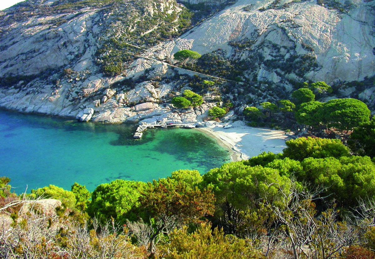
Day 4, Giannutri-Montecristo, 34 miles
For the fourth day of the cruise we visit Montecristo, an island that is a world for itself, absolutely inviolable, wild, authentic and above all, out of time. Those lucky enough to set foot on this granite island know they are entering another dimension. Montecristo is in fact the treasure island par excellence, the place chosen by the writer Alexandre Dumas to set the beautiful novel The Count of Montecristo. Montecristo is subject to strict restrictions for boaters: to disembark on the island it is necessary to ask for a permit from the Forestry Corps of Follonica and only 1,000 visitors are allowed per year.
The only access point is Cala Maestra which, however, becomes prohibitive when the Mistral blows. It has a sandy bottom but it is only possible to dock at the buoy or at the pier. There are two paths that allow you to enjoy the wild nature of Montecristo and both start from Cala Maestra, near the former Villa Reale where there are the homes of the guardians and forest guards, a Naturalistic Museum, a nineteenth-century botanical garden and a beautiful citrus grove. The rest of the island is characterized by holm oak woods that alternate with cliffs and slopes, large boulders sculpted by the wind and cylindrical wells dug by the vortex of the water. The queen and symbol of the island is the wild goat, a beautiful animal very similar to the ibex which in Italy can only be found here. In about an hour walk, you can reach the ruins of the Abbazia di San Mamiliano. From the path that returns you to Cala Maestra there is a detour to the Grotta del Santo, another place of worship dedicated to San Mamiliano. The other walk we suggest is the one that leads to the Belvedere. The path climbs the southern side of Cala Maestra reaching a spectacular ridge overlooking the rocky amphitheater of the island and Cala Santa Maria, an interesting cove worth visiting in calm sea conditions. In those depths there are meadows of posidonia, sea anemones, gorgonians, corals. The presence of the sunfish is common. Other coves also worth seeing are as Cala dei Corvi, Cala del Diavolo or Cala dei Ladri, and rugged promontories such as Punta delle Bozze, Punta dei Fanciulli or Punta Nera.
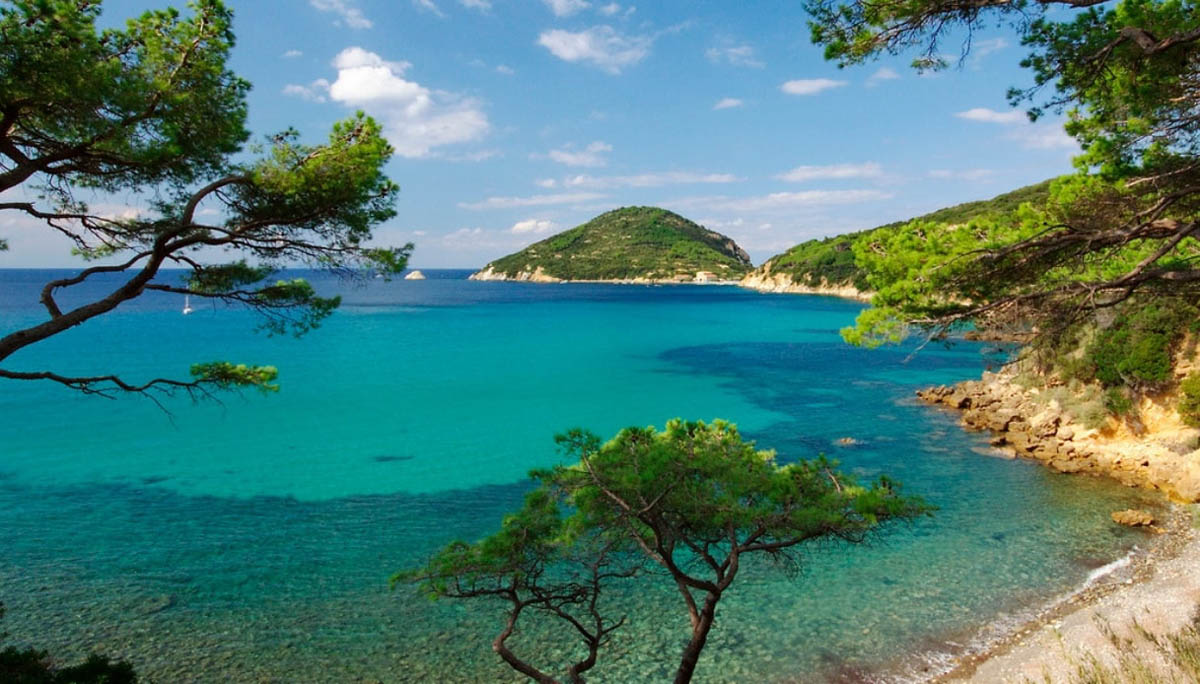
Day 5, Montecristo-Pianosa-Elba, 25 miles
Today the bow is turned towards Elba, but first stop will be in Pianosa. The island until 1997 housed a feared prison, now it is part of the Tuscan Archipelago Park but mooring and navigation within a mile of the coast are always prohibited. However, it is possible to book a visit to this incredible natural oasis. Among the mooring points there are: the wonderful small port in Cala San Giovanni, Cala della Ruta, recognizable by a red quadrangular tower on the south side of the island and Golfo della Botte, on the north west side. Disembarking, you will discover about 500 species of rare plants, including the spectacular specimens of centenary olive trees planted by Napoleon. The buildings here are also specific, such as the Forte Teglia or the incredible Paleochristian Catacombs: a dense network of tunnels, 200 meters long, dug into the rock. Take a swim in Cala Giovanna, a bay with a beach of very fine white sand.
We continue towards Elba. There are six well-protected ports that we can use for mooring, depending on the winds, and numerous small or large coves that are always sheltered. Portoferraio is the main port of the island, with its large and sheltered bay and all nautical services; there is only a bit of undertow with winds from the South West. Alternatively, there is Rio Marina which offers a breakwater, a fixed quay and some floating docks. A good option can also be Porto Azzurro which is formed by a South West facing pier, plus privately operated floating piers. The ports of Cavo and Marina di Campo are smaller, while Marciana Marina, located in front of the village with the same name, is one of the most picturesque moorings on Elba. The shelter is good, but not very protected when the Grecale and Tramontana blow.
Each of these mooring points allow you to visit the magnificent historic centers of the nearby villages, each different and characteristic. The Medici towers, the Renaissance fortresses and the 16th century cathedral of Portoferraio, to the old houses faded by the salt and the stairways overlooking the sea of Marciana Marina, the historic districts with a Spanish atmosphere of Porto Azzurro, the narrow alleys and the small pastel-colored houses of the former Etruscan village of Capoliveri are all worth your time. And then there is the wild nature of the island with its oak and chestnut woods, the mazes of paths, the old mines, the cliffs overlooking the sea and the many bays and beaches to be discovered. Among these are Cala Piscatoio, Cala Perla or the famous bay of Cavoli, and the beaches, such as that of Cavo, Innamorata, Palombaia, Fetovaia, Galenzana and the very white Le Ghiaie and the splendid beach of Portoferraio, with the its crystal clear waters. For those who love diving, arriving near the rock of Ogliera, a rocky promontory located near the town of Pomonte, on the west coast of the island there is a wreck set almost on the surface of the water. This wreck is of the freighter Elviscott which sank in 1972, during a storm, while carrying a load of timber. It is located at just 13 meters of depth, on a sandy bottom, so the wreck can also be reached by those with only some freediving experience.
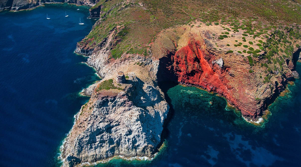
Day 6, Elba-Capraia, 20 miles
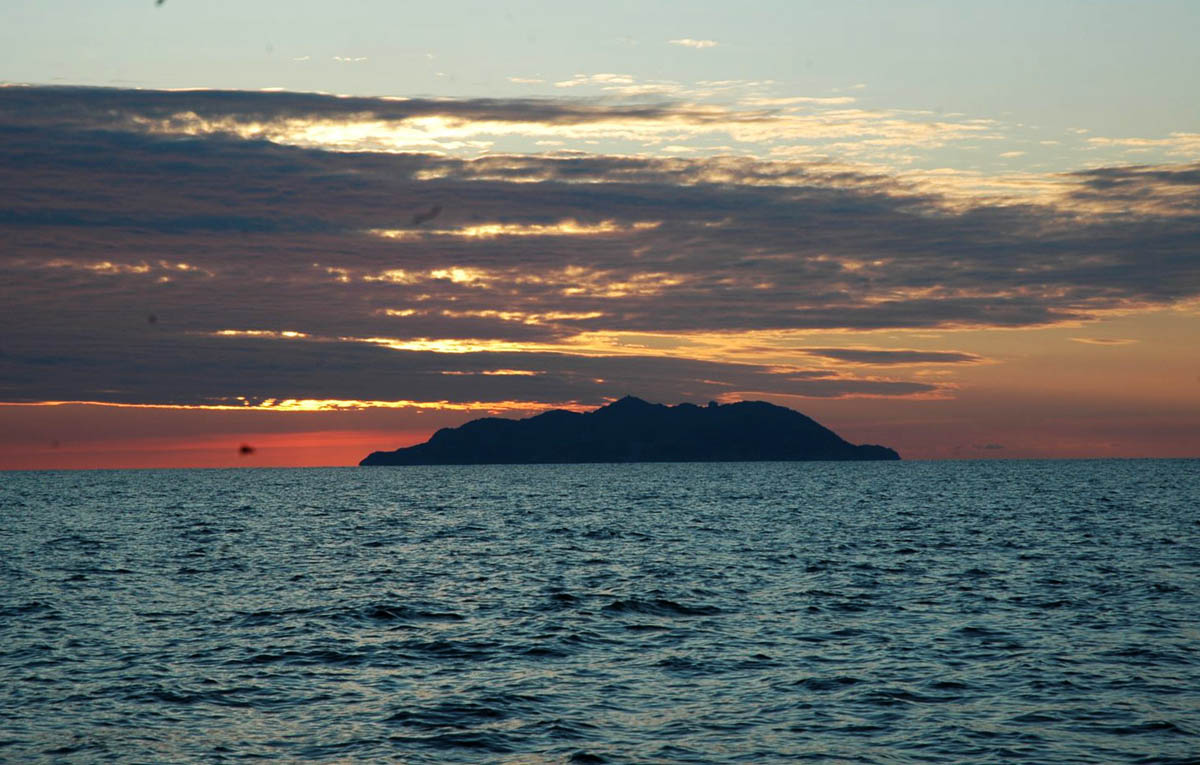
We leave for Capraia. Formerly the site of a prison active from the nineteenth century until 1986, Capraia is the westernmost of the Tuscan islands with a volcanic and rocky soul. You can recongize it already from the open sea thanks to the rugged mass of Mount Arpagna, 447 meters high, which stands out on its north side. The best place for mooring is the port of Capraia, a picturesque harbor surrounded by a small village and located within a beautiful bay that looks like a pirate refuge. The bay of the port is recognized by the lighthouse and the tower that overlook Capo Ferraione. Here you can moor on the quays and on the shore, on a seabed of sand and algae that has a depth of 5-10 meters. The services on the quay include water and electricity, toilets and fuel. On the ground there are also bars, banks, post offices, shops and restaurants.
A short circumnavigation of the island allows you to discover its true essence. In the eastern part you can admire valleys that open onto coves where streams of water flow that create small bends, pebble beaches and caves. Cala Rossa on the south, is a splendid inlet about 100 meters wide and a fascinating mooring place with a contrast between the gray rock of lava origin and the bright red of the basalt. But the fund here is bad tenant. On the west side of Punta Zenobito there is Cala del Moreto, where the mooring is possible at about 10-15 meters of depth on a sand and rock bottom. On the other hand, the coasts on the west side of Capraia is high and rocky and hides caves to explore and natural arches. It was the erosion caused by the wind and the eruptions of the Zenobito volcano that created these large cavities, called “tafoni”. The most famous of the caves is that of Bue Marino and the best known arch is that of Cala del Reciso, truly fascinating and also accessible by swimming. Other scenic points of Capraia are Cala Ceppo, a wide loop exposed to winds from the south and east and dominated by high and spectacular cliffs. Here the best place to anchor is at the north of the inlet on sandy bottoms of 5-8 meters. Also worth seeing are the Carbicina loop and the Scoglione which takes its name from a rock about 5 meters high that emerges from the water.
Day 7 , Capraia-Marina di Scarlino, 40 miles
Our cruise comes to an end and it’s time to return to Marina di Scarlino. It takes 40 miles to reach the boarding base. The more adventurous can head towards Gorgona, the northernmost island of the Tuscan Archipelago, but it takes another 30 miles of route and it would be really tough. Moreover, this island is a protected area and it’s difficult to access because the highly confidential structures of a maximum security prison is located there. Never mind, even so, the Tuscan Archipelago is so rich in beauty that it leaves the heart and eyes satisfied and always leaves us an invitation to return to admire it on board a sailing boat, in silence and respecting this nature that must be preserved.
You May Also Like
Sailing in the Cyclades: amidst ancient myths and dreamy beaches
14/03/2024
How to use a winch without draining the batteries
23/11/2022